
ACTIVE STORM TRACK →
PROPERTY-INSURANCE CLAIM HELP FL CITIESSC CITIESGUIDESTATESNEWSSITE MAPABOUT
HurricaneLaw.Pro, Florida and South Carolina property insurance claim resource HURRICANELAW.PRO
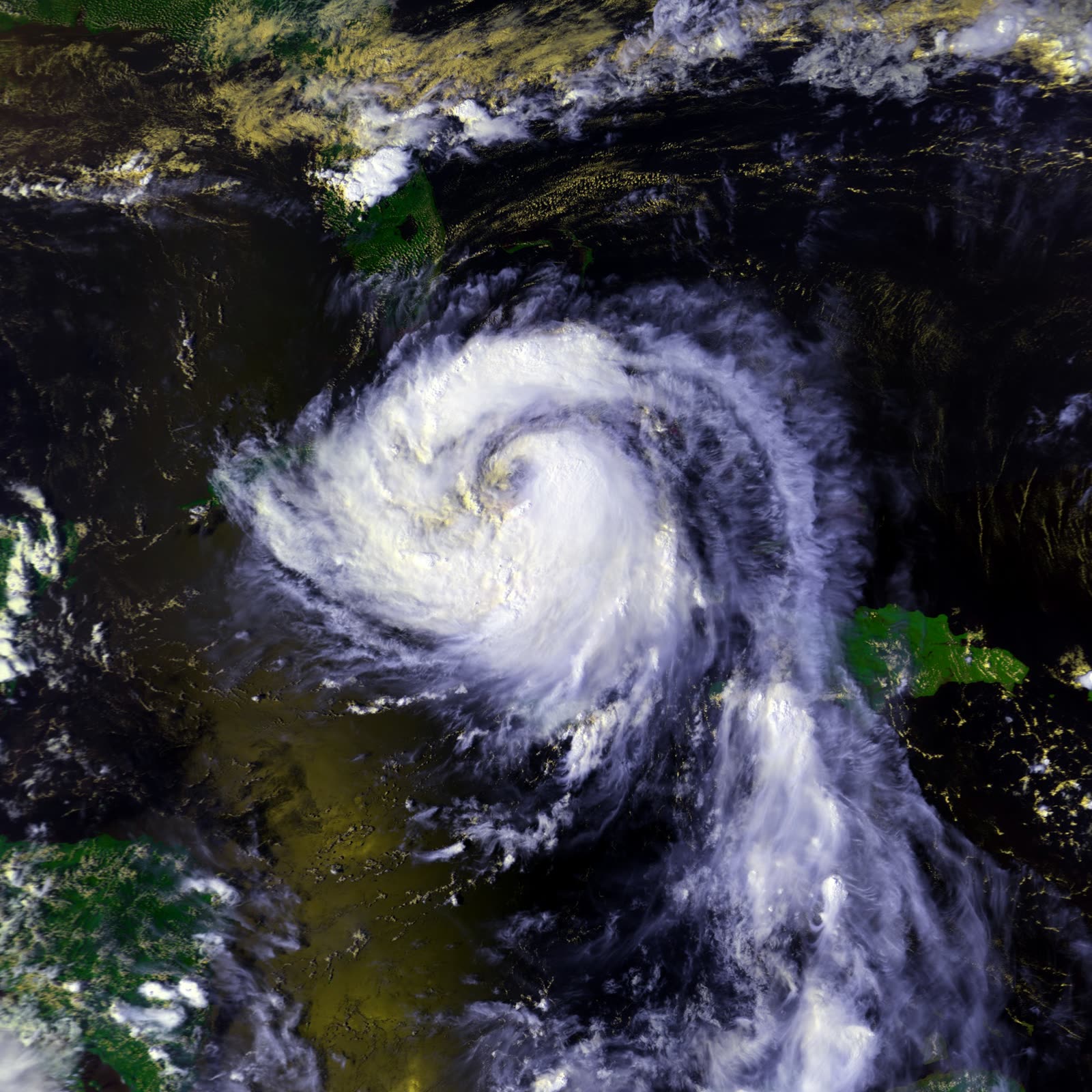
Georges crossing Cuba toward the Florida Straits on September 24, 1998, the day before its Key West landfall
STORM ARCHIVE / 1998 LANDFALL 24.6°N 81.8°W
2 (FL) AT LANDFALL PEAK CAT 4 FL · 1998 · 155 mph

Hurricane Georges

Landfall: Key West, FL → Biloxi, MS · 1998-09-25. 173 Keys homes destroyed, many of them mobile homes, reigniting the fight over whether trailers belong in a surge zone at all

NOAA / NESDIS (GOES-8)
AT LANDFALL
2 (FL)
PEAK INTENSITY
CAT 4 · 155 mph
PRESSURE
964 mb (Key West landfall)
STORM SURGE
12 ft
DAMAGE
$9.37B total
DEATHS
604
01 THE PATH

Where it hit, start to finish

TRACK · HURRICANE GEORGESNOAA / NHC (best-track data)
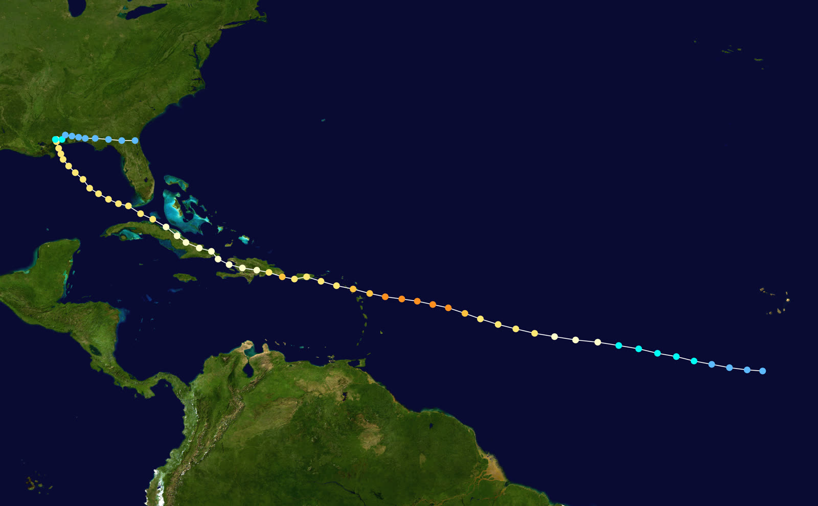
Best track of Hurricane Georges, September 15 - October 1, 1998 - seven landfalls from the Leewards to Biloxi
Leeward Islands / Puerto Rico
CAT 4 PEAK - 155 MPH

Georges formed September 15, 1998, peaked at 155 mph and 937 mb, then raked Antigua, St. Kitts, and Puerto Rico as a major hurricane on September 21.

Hispaniola / Cuba
600 CARIBBEAN DEATHS

Landfall in the Dominican Republic September 22 at 120 mph; mountain rains and mudslides killed 380 there and 209 in Haiti. Georges crossed eastern Cuba September 23 and re-emerged over the Florida Straits.

Key West, FL
CAT 2 LANDFALL - 105 MPH

Landfall 11:30 a.m. EDT September 25 with 105 mph sustained winds and 964 mb; gusts near the center reached 125 mph, with a 96-knot gust at Marathon's EOC. Over 1.2 million Floridians had been ordered out; more than 7,000 Key West residents stayed.

Tavernier / the Keys
12-FOOT SURGE OVER 7-FOOT ISLANDS

Surge to 12 feet at Tavernier swept island terrain averaging 7 feet of elevation. All the Keys lost power; 1,536 houses were damaged and 173 destroyed - many of them mobile homes, including rows on Ohio Key. Keys damage: about $200 million; two Monroe County deaths.

Florida Panhandle
38.46 INCHES OF RAIN AT MUNSON

Georges crawled ashore again near Biloxi September 28 and stalled. Munson, FL recorded 38.46 inches - the storm's US rainfall maximum. Escambia County alone counted 639 homes damaged; Panhandle damage topped $100 million, and Georges spawned 17 Florida tornadoes, the most in a hurricane since Agnes in 1972.

Gulf Coast
DISSIPATION

Georges died over the Gulf Coast around October 1. Full toll: 604 deaths (one direct US death, in Alabama) and $9.37 billion in damage; Florida's share reached at least $340 million with five deaths.

02 THE RECORD IN IMAGES
ALL IMAGERY U.S. GOV / PUBLIC DOMAIN
SATELLITE NOAA / NESDIS
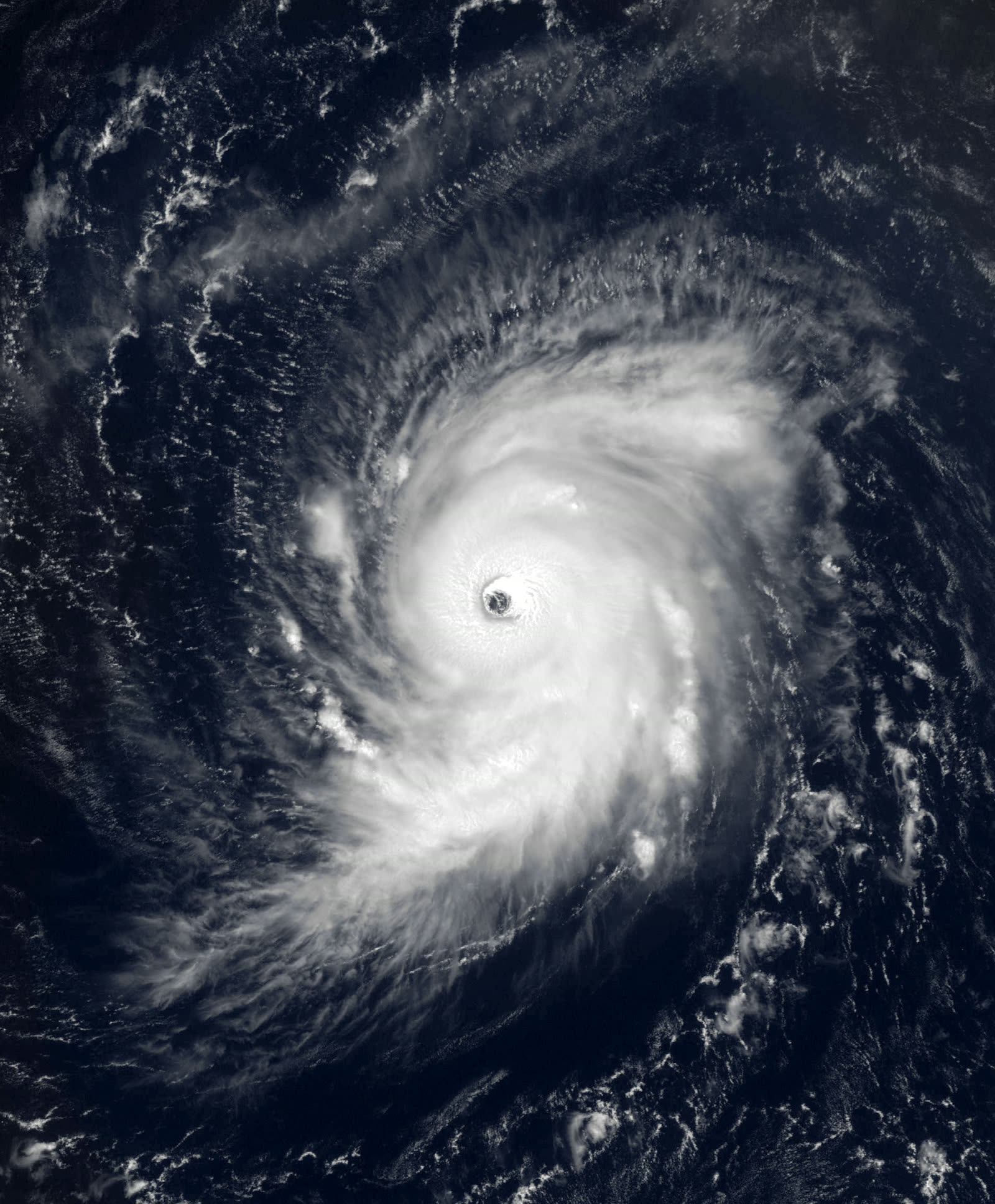
Georges near Category 4 peak intensity (155 mph, 937 mb) east of the Leeward Islands, September 19, 1998

The storm

Georges was the 1998 season's marathon: seven landfalls over 17 days. It formed off Africa on September 15, peaked at Category 4, 155 mph, 937 mb, east of the Leewards, then ground across Antigua, St. Kitts, Puerto Rico, the Dominican Republic, Haiti, and Cuba. Mountain rains on Hispaniola killed nearly 600 people.

Cuba's terrain knocked Georges down, but the Florida Straits gave some strength back. On September 25 at 11:30 a.m. EDT, the eye crossed Key West with 105 mph sustained winds and 964 mb, a strong Category 2, with gusts to 125 mph near the center. Surge reached 12 feet at Tavernier, on islands whose average elevation is about 7 feet.

Georges then spent three more days over the Gulf before a final landfall near Biloxi on September 28, where it stalled and unloaded, 38.46 inches of rain at Munson in the Florida Panhandle, the storm's US maximum. Total: 604 deaths and $9.37 billion in damage across the basin.
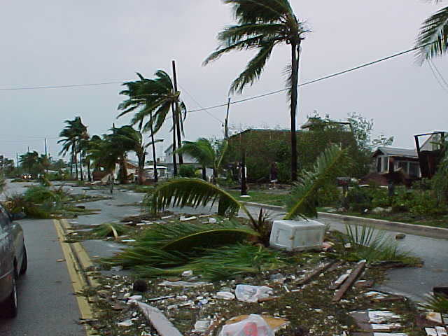
Wrecked boats and debris in Key West after Georges - the harbor's houseboat rows were largely destroyed
Wrecked boats and debris in Key West after Georges - the harbor's houseboat rows were largely destroyed US Government (public domain)

The damage

In the Keys, water did what wind started. All of the island chain lost power. Georges damaged 1,536 houses and destroyed 173, a disproportionate share of them mobile homes, including rows of trailers on Ohio Key. Key West's houseboat community was wrecked, boats piled into streets and mangroves. Keys damage totaled about $200 million, with two Monroe County deaths. More than 1.2 million Floridians had been ordered to evacuate; over 7,000 Key West residents refused and rode it out.

The Panhandle took the second Florida hit days later: 10 feet of surge and days of rain from the stalled storm. Escambia County counted 639 damaged homes; regional damage passed $100 million. Seventeen tornadoes, Florida's most in a hurricane since Agnes (1972), added scattered losses. Florida statewide: at least $340 million and five deaths.
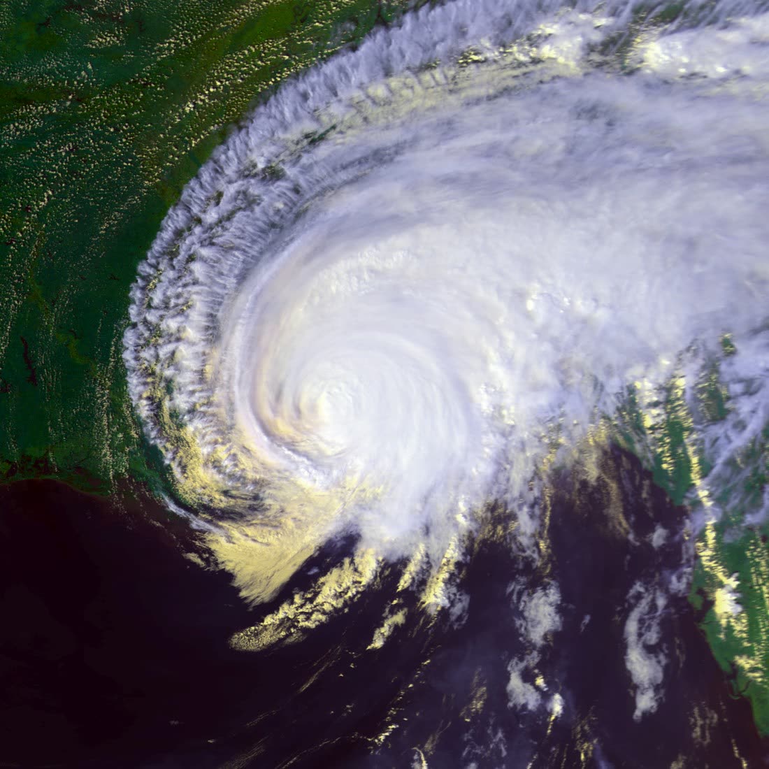
Georges making its final landfall near Biloxi, Mississippi, September 28, 1998, after three days over the Gulf
Georges making its final landfall near Biloxi, Mississippi, September 28, 1998, after three days over the Gulf NOAA / NESDIS (GOES-8)

The insurance aftermath

Georges produced a claims surge in the hardest place in Florida to insure. Monroe County in 1998 was already a residual-market county, post-Andrew, private carriers had largely stopped writing wind in the Keys, pushing homeowners into the FWUA wind pool for wind and the NFIP for flood. A Georges claim was therefore routinely a three-policy event: wind pool, flood policy, and a homeowners policy covering neither peril. Policyholders spent months arguing over which insurer owned which damage, surge stains versus wind-driven rain versus rain through wind-opened roofs, with each carrier positioned to point at the other two.

The destroyed-housing data drove the sharper debate. With mobile homes making up much of the 173 destroyed structures, Georges reignited the argument over trailer exposure in a surge zone: pre-1994 mobile homes predated the post-Andrew HUD wind standards, were effectively uninsurable at market rates, and sat on some of the lowest ground in the county. NFIP substantial-damage rules meant units damaged beyond 50% of value could not simply be replaced in kind below base flood elevation, a rebuilding constraint that collided with the Keys' role as its own workforce housing. County officials, FEMA, and owners fought over enforcement; the trailer-park question Georges posed was still open when Irma answered it more brutally in 2017.

Federal recovery ran through DR-1249, declared September 28 for 13 counties; by December federal aid exceeded $71 million in grants, loans, and housing assistance, much of it standing in for coverage the private market had already withdrawn.
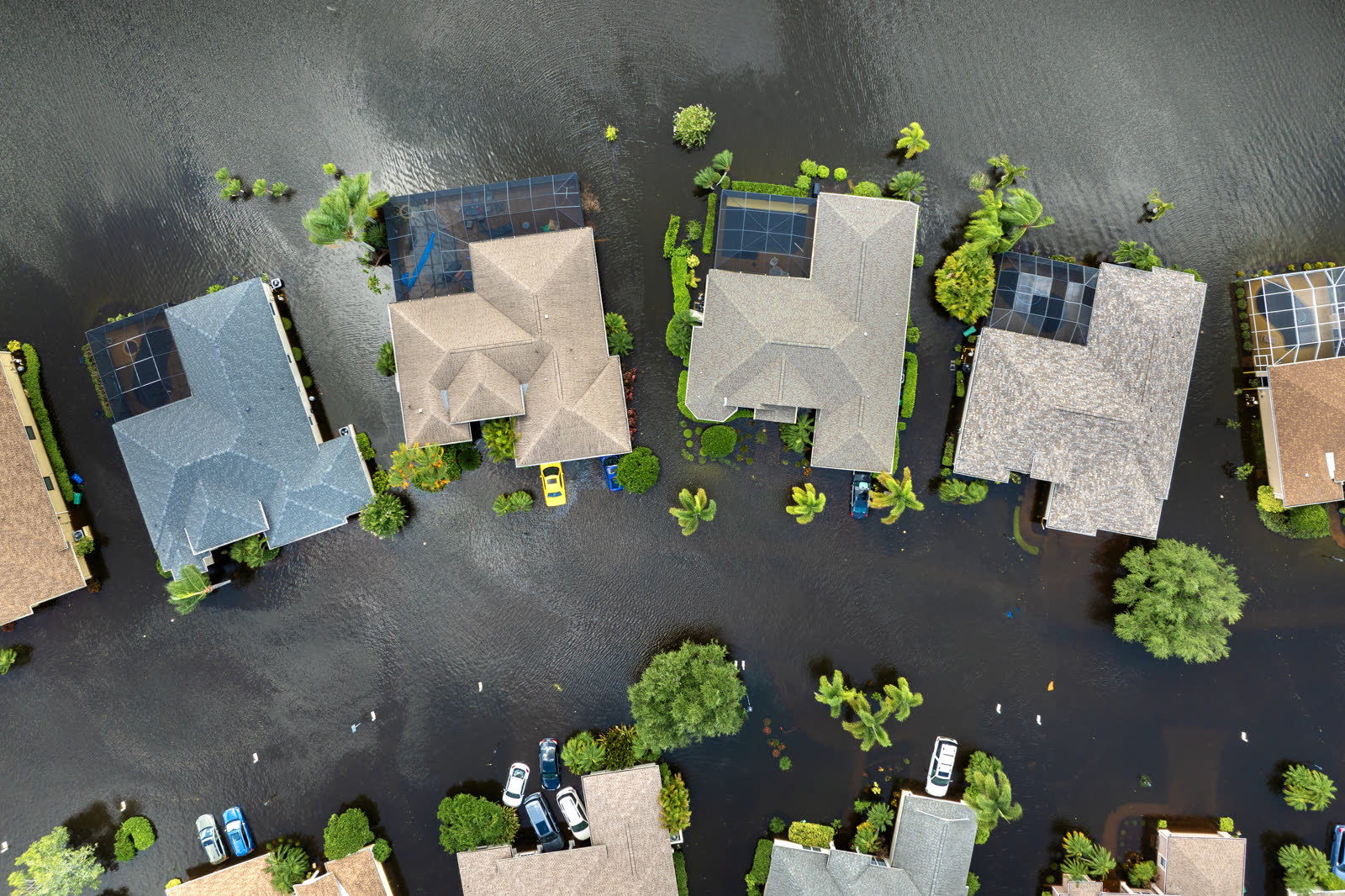
Tropical-storm flooding, Florida
Tropical-storm flooding, Florida REPRESENTATIVE FOOTAGE

What policyholders learned

  • Multi-policy claims fragment accountability. Keys owners with separate wind-pool, flood, and homeowners policies saw each carrier attribute damage to a peril it didn't cover; owners who documented damage by cause and timing early kept the allocation honest.
  • Surge on low islands is a flood claim, full stop. At 7 feet of elevation under 12 feet of water, most Keys structural loss fell to NFIP policies and their limits, not to wind coverage.
  • Mobile homes concentrated the uninsured loss. Older, pre-HUD-standard units were the likeliest to be destroyed and the least likely to carry adequate coverage; FEMA aid, not insurance, funded most trailer losses.
  • The 50% rule changes what "rebuild" means. Substantially damaged structures in the floodplain faced elevation and code requirements that insurance proceeds alone rarely covered.
  • Evacuation refusals had claims consequences too. Owners present during the storm could document wind damage preceding surge, evidence that mattered later; but staying also meant two Monroe County deaths.

Not legal advice; consult an attorney about your specific claim. Damage figures are nominal (not inflation-adjusted) unless noted.

AT LANDFALL · HURRICANE GEORGES · 1998
12 ft
OF STORM SURGE · TAVERNIER
REPRESENTATIVE FOOTAGE
03 THE FULL RECORD

Every official record of Georges

Reports, imagery archives, flood data, and claims records, straight from the agencies.

FREE CASE REVIEW · NO FEE UNLESS YOU RECOVER
Georges claim denied?
CALL SC · 843-542-0454CALL FL · 813-588-0164FREE CLAIM REVIEW
RELATED GUIDES
HurricaneLaw.Pro, Florida and South Carolina property insurance claim resource HURRICANELAW.PRO

A comprehensive property-insurance claim resource for policyholders: denied and underpaid claims, coverage and bad-faith law, storm dossiers, carrier profiles, city guides, and the complete claims playbook. Florida and South Carolina.

▸ SEE THE FULL SITE MAP →
STORM ALERTS SOURCED FROM NOAA / NHC
SOUTH CAROLINA
496 Bramson Court, Suite 100
Mount Pleasant, SC 29464
CALL OR TEXT
FLORIDA
CALL OR TEXT
CLAIMS 9
BAD FAITH 7
DENIAL FILINGS
HOW CLAIMS GET DENIED
DENIAL DOCUMENTS
DENIALS, ANSWERED 9
COVERAGE 13
COMMERCIAL 8
ROOFS 8
TREES 5
DIRECTORIES
STORMS 51
WEATHER
NEWS & SITE 22
STORM ARCHIVE, CITIES & NEWS
Most recent below. Every storm dossier, city resource, and article is on its hub (linked at each heading) or the grouped site map →. All 73 carriers and 95 public-adjuster firms are in the Directories column above.
STORM ARCHIVE · 51 →
Hurricane Debby 2024Hurricane Helene 2024Hurricane Milton 2024Hurricane Idalia 2023Hurricane Ian 2022Hurricane Nicole 2022Hurricane Ida 2021Hurricane Laura 2020 View all 51 →
FLORIDA CITY RESOURCES · 37 →
Boca RatonBradentonCape CoralClearwaterCrestviewDaytona BeachDestinDunedin View all 37 →
SOUTH CAROLINA CITY RESOURCES · 8 →
BeaufortCharlestonColumbiaFlorenceGreenvilleHilton Head IslandMount PleasantMyrtle Beach
NEWS & UPDATES · 22 →

Coverage summaries, policy-language quotations, dollar figures, deadlines, and chart examples throughout this site are general information based on typical or standard policy forms and are illustrative only: they are not a quote, a guarantee of coverage, or a promise of any outcome. Every insurance policy is different: your own policy, endorsements, and state law control, so read your policy and confirm current statutes. Weather imagery courtesy of NOAA, the National Hurricane Center, and the National Weather Service. Legal services are provided by Halversen Law. Nothing on this site is legal advice; consult an attorney about your specific claim.

PrivacyTermsDisclaimerAboutContact
This site is not legal advice, and it is not a substitute for an attorney. Anything legal needs a licensed lawyer reading your policy and your facts. We recommend Halversen Law: the free claim review is the fastest way to get real eyes on your claim.
© 2026 HURRICANELAW.PRO · ALL RIGHTS RESERVED 27.9°N 82.5°W · ATLANTIC BASIN MONITOR
LAW FIRM
Halversen Law LICENSED · FLORIDA & SOUTH CAROLINA

Legal matters are handled by Halversen Law, a law firm licensed in Florida and South Carolina.

FREE CASE REVIEW