
ACTIVE STORM TRACK →
PROPERTY-INSURANCE CLAIM HELP FL CITIESSC CITIESGUIDESTATESNEWSSITE MAPABOUT
HurricaneLaw.Pro, Florida and South Carolina property insurance claim resource HURRICANELAW.PRO
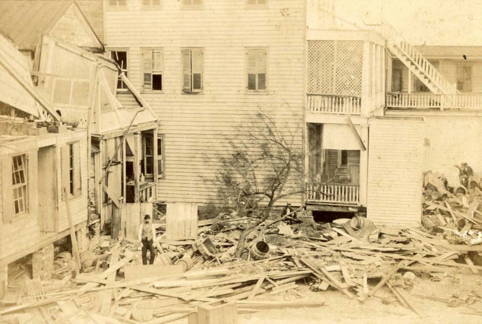
Wrecked houses in Beaufort, South Carolina after the August 27, 1893 hurricane
STORM ARCHIVE / 1893
CAT 3 SC · 1893 · 120 mph

Sea Islands Hurricane

Landfall: Beaufort sea islands, SC (center ashore near Savannah, GA) · 1893-08-27. No insurance and no government aid existed, recovery ran entirely on the Red Cross's first major disaster-relief operation, privately funded for 10 months

Beaufort County Library (public domain)
AT LANDFALL
CAT 3
PEAK WIND
120 mph
PRESSURE
954 mb (landfall, est.)
STORM SURGE
16 ft
DAMAGE
$1M+ (1893)
DEATHS
1,000-2,000
01 THE PATH

Where it hit, start to finish

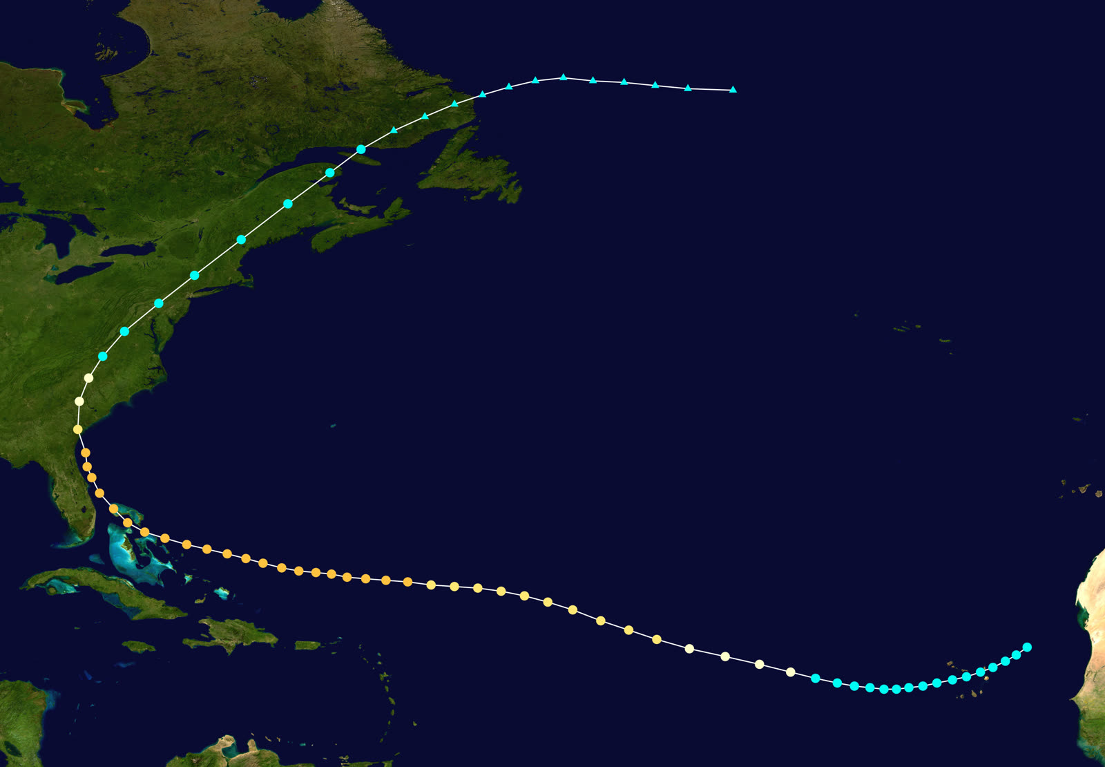
TRACK · SEA ISLANDS HURRICANENOAA / HURDAT (best-track data)
Best track and intensity of the 1893 Sea Islands hurricane, August 15-September 2, 1893
Eastern Atlantic
CAPE VERDE ORIGIN

A tropical storm formed east of Cape Verde on August 15, 1893 and became a hurricane on August 19, a classic long-track Cape Verde hurricane, tracked only by ship reports in the pre-forecast era.

Near Savannah, GA
LANDFALL - 120 MPH

The center came ashore near Savannah on the night of August 27, 1893, with winds near 120 mph and an estimated 954 mb pressure. Residents had almost no warning.

Beaufort sea islands, SC
16-FT SURGE AT NIGHT ON A HIGH TIDE

Surge of about 16 feet, modeled locally to 30 feet, swept over the low-lying islands in darkness. Coosaw, Lady's, Parris, St. Helena, and Port Royal islands went underwater. An estimated 1,000-2,000 people drowned, the 7th-deadliest hurricane in U.S. history.

Beaufort, SC
COUNTY SEAT WRECKED

Bay Street and much of the town were flooded and wrecked. Roughly 30,000 people, most of them Black farmers and phosphate workers, were left homeless, sick, or destitute across the islands.

Coosaw River basin, SC
PHOSPHATE INDUSTRY DESTROYED

Beaufort County produced about 80% of U.S. phosphate in 1893. The industry's dredges, barges, and works were afloat when the storm hit and were destroyed, the region's economic base gone in one night.

Inland SC to Atlantic Canada
DISSIPATION

The storm crossed South Carolina on August 28, weakened inland, and went extratropical over Atlantic Canada. A second hurricane struck near Charleston on October 13, hampering relief.

02 THE RECORD IN IMAGES
ALL IMAGERY U.S. GOV / PUBLIC DOMAIN
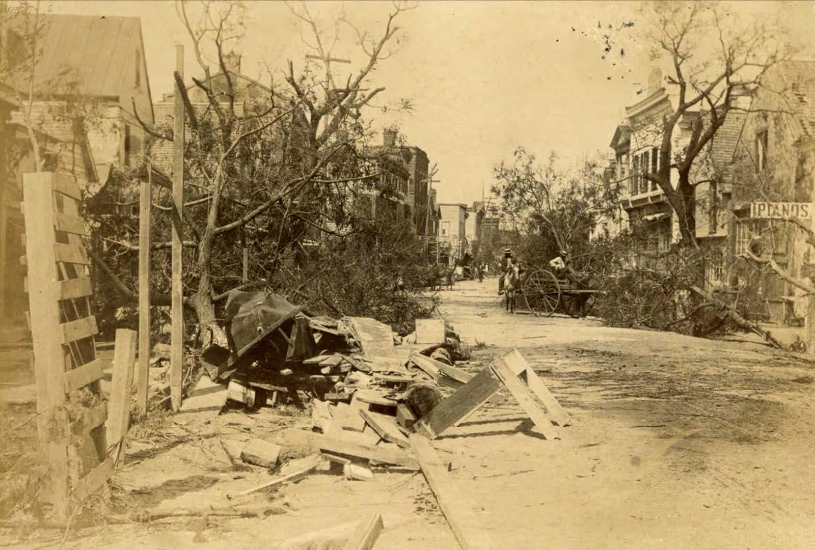
DAMAGE Beaufort County Library (public domain)
Trees and buildings down on Bay Street, Beaufort's commercial waterfront
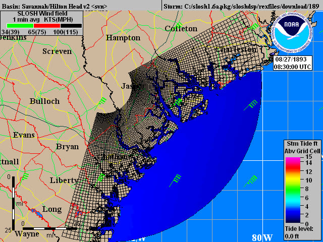
SURGE NOAA / AOML
Track and modeled storm surge of the 1893 Sea Islands hurricane

The storm

The Sea Islands hurricane formed east of Cape Verde on August 15, 1893, reached hurricane strength on August 19, and crossed the Atlantic on a long, classic Cape Verde track. Modern reanalysis puts its landfall intensity near 120 mph, Category 3, with an estimated central pressure of 954 mb, and possibly Category 4-5 strength at sea.

The center came ashore near Savannah, Georgia, on the night of August 27, 1893, then moved north across South Carolina on August 28. The right-front quadrant put the strongest winds and the full storm surge onto the Beaufort sea islands. Surge reached about 16 feet above sea level by Clara Barton's account; NOAA modeling suggests some areas were inundated up to 30 feet. It arrived at night, on a high tide, in an era with no radio, no forecasts, and no evacuation.

Between 1,000 and 2,000 people drowned, nearly all on the low islands between Savannah and Charleston. It remains the 7th-deadliest hurricane in U.S. history.
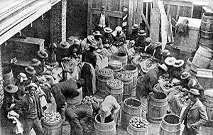
Red Cross workers sort seed potatoes to replant inundated Sea Islands fields, the operation ran 10 months
Red Cross workers sort seed potatoes to replant inundated Sea Islands fields, the operation ran 10 months American Red Cross (public domain)

The damage

The sea islands, Coosaw, Lady's, Parris, St. Helena, Port Royal, Edisto, went underwater. A witness on Edisto described water that "spread itself over the surrounding country like an endless inland lake." Beaufort, the county seat, was wrecked; photographs show Bay Street's commercial row shattered and houses pushed off foundations. On Tybee Island, Georgia, homes and the beach railroad were destroyed.

The economic core of the region went with the housing stock. Beaufort County produced roughly 80% of the phosphate used in U.S. fertilizer in 1893. Much of the industry's capital, dredges, barges, river works, was floating on the rivers when the storm struck and was simply lost. The phosphate industry never recovered, and Beaufort County did not return to its pre-storm economic level until World War II.

An estimated 30,000 survivors, most of them Black farmers and laborers descended from the islands' freedmen communities, were left homeless with no clean water, no food, and their fields poisoned by salt.
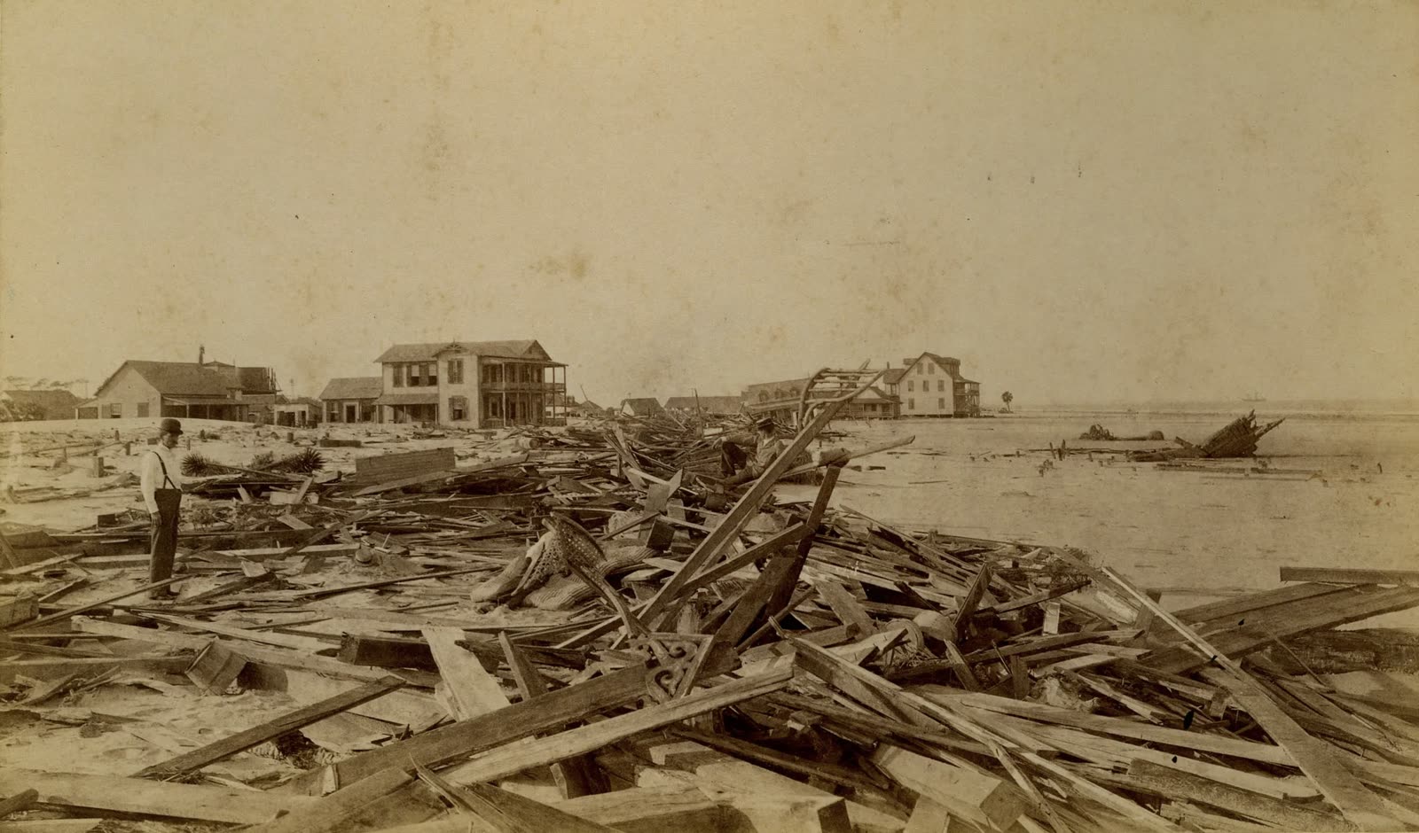
Destroyed homes on Tybee Island, Georgia, near where the center came ashore
Destroyed homes on Tybee Island, Georgia, near where the center came ashore Georgia Historical Society (public domain)

The insurance aftermath

There was no insurance aftermath, and that is the point of this storm's record. Property insurance was effectively nonexistent for the Sea Islands' Black landowners, there was no flood insurance anywhere in America, and neither the State of South Carolina nor Congress appropriated a single dollar of relief. Every institution policyholders rely on today was absent.

What filled the vacuum was the American Red Cross's first major disaster-relief operation. Clara Barton, then 71, arrived in Beaufort about six weeks after the storm and ran a privately funded relief campaign for 10 months, warehouses of food and clothing in Beaufort, seed potatoes to replant salted fields, materials for survivors to rebuild their own houses. By summer 1894 the islands' population was housed and producing food again. The operation became the template for American disaster relief and helped drive the Red Cross's congressional charter.

The relief was also politicized. Newspapers and politicians pressed the Red Cross to redirect supplies toward white farming communities, and state leaders worked against Black islanders' efforts to rebuild financial security, an early, documented case of disaster recovery deepening existing inequities.

For the insurance record, 1893 is the baseline: a catastrophic surge event with zero risk transfer. Every mechanism that exists today, NFIP flood coverage, wind pools, federal disaster declarations, FEMA grants, was built in reaction to storms like this one.
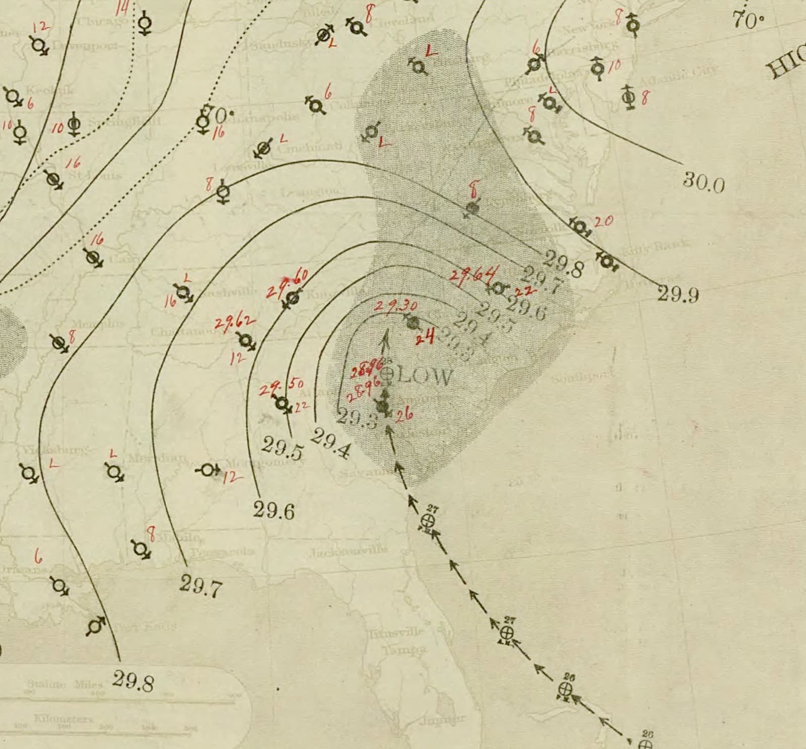
U.S. Weather Bureau surface map, August 28, 1893, the hurricane over the Southeast
U.S. Weather Bureau surface map, August 28, 1893, the hurricane over the Southeast NOAA Central Library / U.S. Weather Bureau

What policyholders learned

  • Uninsured catastrophe is the historical default, not the exception. Before NFIP (1968) and federal disaster programs, a surge event meant total, permanent loss. Coverage bought before a storm is the only mechanism that has ever reliably paid to rebuild.
  • Surge is a flood peril. The 1893 deaths and losses were water, not wind. The same distinction drives modern claim outcomes: homeowners policies exclude the peril that did the killing here.
  • Private charity is capped and slow. Even the largest relief operation of its era took six weeks to arrive and rebuilt to subsistence, not to pre-loss condition. Modern FEMA grants carry the same limitation; they are not a substitute for coverage.
  • Relief distribution follows politics. Documented diversion of 1893 supplies away from Black communities foreshadowed modern disparities in claim and aid outcomes; policyholders with records and advocates fared better then and fare better now.
  • Economic loss outruns property loss. The phosphate industry's destruction depressed Beaufort County for five decades. Business-interruption and time-element coverage exist because rebuilding a structure does not rebuild an economy.

Not legal advice; consult an attorney about your specific claim. Damage figures are nominal (not inflation-adjusted) unless noted.

AT LANDFALL · SEA ISLANDS HURRICANE · 1893
16 ft
OF STORM SURGE · SEA ISLANDS; MODELED LOCALLY TO 30 FT
REPRESENTATIVE FOOTAGE
03 THE FULL RECORD

Every official record of Sea Islands Hurricane

Reports, imagery archives, flood data, and claims records, straight from the agencies.

FREE CASE REVIEW · NO FEE UNLESS YOU RECOVER
Sea Islands Hurricane claim denied?
CALL SC · 843-542-0454CALL FL · 813-588-0164FREE CLAIM REVIEW
RELATED GUIDES
HurricaneLaw.Pro, Florida and South Carolina property insurance claim resource HURRICANELAW.PRO

A comprehensive property-insurance claim resource for policyholders: denied and underpaid claims, coverage and bad-faith law, storm dossiers, carrier profiles, city guides, and the complete claims playbook. Florida and South Carolina.

▸ SEE THE FULL SITE MAP →
STORM ALERTS SOURCED FROM NOAA / NHC
SOUTH CAROLINA
496 Bramson Court, Suite 100
Mount Pleasant, SC 29464
CALL OR TEXT
FLORIDA
CALL OR TEXT
CLAIMS 9
BAD FAITH 7
DENIAL FILINGS
HOW CLAIMS GET DENIED
DENIAL DOCUMENTS
DENIALS, ANSWERED 9
COVERAGE 13
COMMERCIAL 8
ROOFS 8
TREES 5
DIRECTORIES
STORMS 51
WEATHER
NEWS & SITE 22
STORM ARCHIVE, CITIES & NEWS
Most recent below. Every storm dossier, city resource, and article is on its hub (linked at each heading) or the grouped site map →. All 73 carriers and 95 public-adjuster firms are in the Directories column above.
STORM ARCHIVE · 51 →
Hurricane Debby 2024Hurricane Helene 2024Hurricane Milton 2024Hurricane Idalia 2023Hurricane Ian 2022Hurricane Nicole 2022Hurricane Ida 2021Hurricane Laura 2020 View all 51 →
FLORIDA CITY RESOURCES · 37 →
Boca RatonBradentonCape CoralClearwaterCrestviewDaytona BeachDestinDunedin View all 37 →
SOUTH CAROLINA CITY RESOURCES · 8 →
BeaufortCharlestonColumbiaFlorenceGreenvilleHilton Head IslandMount PleasantMyrtle Beach
NEWS & UPDATES · 22 →

Coverage summaries, policy-language quotations, dollar figures, deadlines, and chart examples throughout this site are general information based on typical or standard policy forms and are illustrative only: they are not a quote, a guarantee of coverage, or a promise of any outcome. Every insurance policy is different: your own policy, endorsements, and state law control, so read your policy and confirm current statutes. Weather imagery courtesy of NOAA, the National Hurricane Center, and the National Weather Service. Legal services are provided by Halversen Law. Nothing on this site is legal advice; consult an attorney about your specific claim.

PrivacyTermsDisclaimerAboutContact
This site is not legal advice, and it is not a substitute for an attorney. Anything legal needs a licensed lawyer reading your policy and your facts. We recommend Halversen Law: the free claim review is the fastest way to get real eyes on your claim.
© 2026 HURRICANELAW.PRO · ALL RIGHTS RESERVED 27.9°N 82.5°W · ATLANTIC BASIN MONITOR
LAW FIRM
Halversen Law LICENSED · FLORIDA & SOUTH CAROLINA

Legal matters are handled by Halversen Law, a law firm licensed in Florida and South Carolina.

FREE CASE REVIEW